


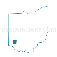
0076 SOL-V-S Voting District, Warren County, Ohio
About
Outline

Summary
| Unique Area Identifier | 653038 |
| Name | 0076 SOL-V-S Voting District |
| County | Warren County |
| State | Ohio |
| Area (square miles) | 1.97 |
| Land Area (square miles) | 1.90 |
| Water Area (square miles) | 0.07 |
| % of Land Area | 96.57 |
| % of Water Area | 3.43 |
| Latitude of the Internal Point | 39.36754390 |
| Longtitude of the Internal Point | -84.21931480 |
Maps


Graphs
Select a template below for downloading or customizing gragh for 0076 SOL-V-S Voting District, Warren County, Ohio


Neighbors
Neighoring Voting District (by Name) Neighboring Voting District on the Map
- 0019 LEB-C-SW Voting District, Warren County, OH
- 0060 HAM-T-NW Voting District, Warren County, OH
- 0075 SOL-V-N Voting District, Warren County, OH
- 0085 UNION-T-W Voting District, Warren County, OH
- 0109 SOL-V-M Voting District, Warren County, OH
- 0165 HAM-T-NE Voting District, Warren County, OH
- 0166 HAM-T-MB Voting District, Warren County, OH
Top 10 Neighboring County Subdivision (by Population) Neighboring County Subdivision on the Map
- Hamilton township, Warren County, OH (23,556)
- Lebanon city, Warren County, OH (20,033)
- Union township, Warren County, OH (4,696)
Top 10 Neighboring Place (by Population) Neighboring Place on the Map
Top 10 Neighboring Unified School District (by Population) Neighboring Unified School District on the Map
- Lebanon City School District, OH (37,690)
- Little Miami Local School District, OH (29,636)
- Kings Local School District, OH (24,764)